 |
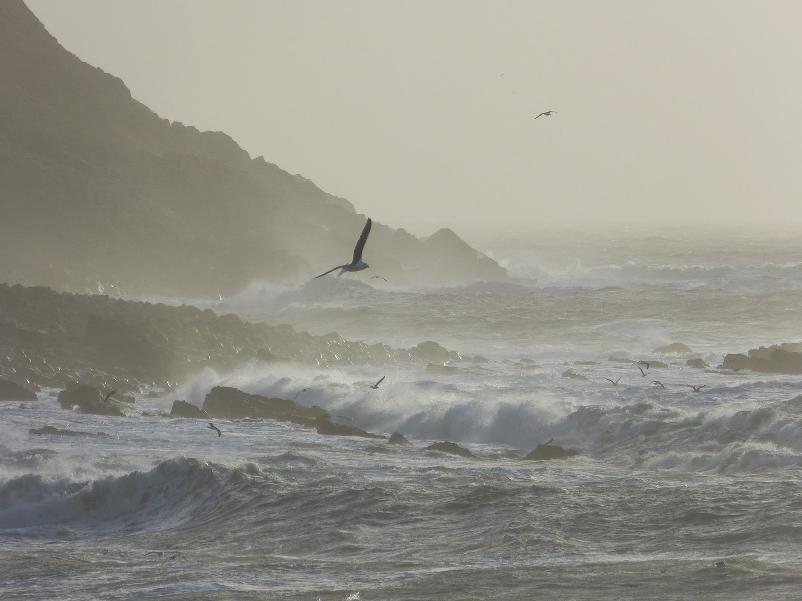
| The sea off Portland 7 January 2014 |
The UK has been battered by storms this week. Strong winds and heavy rain have caused severe flooding in some parts, with ferocious seas and swollen rivers bursting their banks. Down the road from where I live in Weymouth, the road over to the Isle of Portland was closed and the siren was sounded to indicate that the sea defences had been breached. Chesil Beach has been re-sculpted. Instead of steps of shingle down to the sea, there is now a steep wall of pebbles.
 |
| Chesil Beach 7 January 2014 |
But this is nothing to the damage caused by the storm of 22-23 November 1824, known as the Great Gale. The storm that hit the south coast of England on the night of the 22 November 1824 is the worst that Weymouth and Portland has ever seen. Hurricane-force winds combined with spring tides to produce tsunami-like waves that topped Chesil Beach.
Chiswell village destroyed
The sea water crashed over the top of Chesil Beach, crushing the village of Chiswell with the force of the sea. More than 30 houses were destroyed and many more made uninhabitable. At least 25 people lost their lives, swept away by the water or crushed beneath the ruins of their homes.
The Gentleman’s Magazine reported:
Disaster at Ferry BridgeThe destruction of lives and property at Chiswell, Portland Island, Dorset, has been most dreadful; about twenty men, women, and children, were found dead and missing, and more than two hundred persons were without a habitation, and not a particle of property left them. There was scarcely a boat left out of the great number that belonged to the fishermen of the island. Whole streets were swept away in less than half an hour from the time the sea first made in, which was about six o’clock in the morning, and the cries of despair and suffering of the poor unfortunates upon whom the houses were falling, was dreadful. Numbers were dangerously wounded and bruised in their courageous and humane endeavours to rescue others from death.1
 |
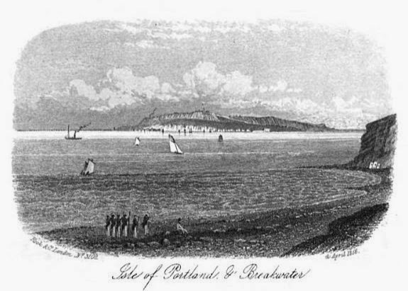
| The Isle of Portland from Weymouth as a Watering Place (1857) |
The wild waters eroded Chesil’s pebbled bank and 'the Chisel Bank throughout its whole extent was lowered some twenty to thirty feet.'2
The rope-drawn ferry that operated between the mainland of Weymouth at Wyke and the Isle of Portland, was destroyed by the storm. The ferryman’s cottage was swept away and the ferryman was drowned trying to save a horse.
The sandbank which had previously enabled horses and wagons to drive across to the Island at low water was completely washed away and the gap between Wyke and Portland was four times as big. For some days, Portland was completely cut off from the mainland.
Weymouth seafront smashed to pieces
 |
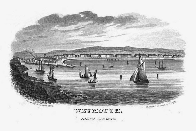
| Weymouth seafront from Weymouth and Melcombe Regis New Guide by E Groves (1835) |
The rector of Wyke recorded:
The pier of Weymouth Harbour was materially damaged, and three fourths of the esplanade at Melcombe Regis entirely thrown down and demolished.2The stone posts and chains were pulled from their places and destroyed. Waves poured over the road and flooded the houses on the seafront in Gloucester Row and the Crescent with sand, water and gravel. Boats were torn from their moorings and destroyed or carried down the main streets as if they were at sea.
At a place called the Narrows where the Weymouth backwater joined the sea over the road, two people were swept away and drowned.
The Gentleman’s Magazine reported:
At the Preston end of Weymouth, the sea again swept over the road and flooded Lodmor flat – where Lodmoor Country Park is today.The breakwater, and nearly the whole of the esplanade are washed away. The houses near the sea had four feet of water on their basements.1
 |
| A stone on Weymouth seafront commemorating the destruction of Weymouth esplanade in 1824 |
More local destruction
Further west along the coast at Abbotsbury, seven metres of floodwater were recorded. At East Fleet, a tidal wave picked up a haystack and other debris and crashed into the village. The church and several cottages were wrecked. In Dorchester, a falling chimney stack killed the Reverend Richman and his wife in their bed.
 |
| A post marking the high water mark from the 1824 storm, the Swannery, Abbotsbury |
Shipwrecks
The storm wrought havoc on the seas causing shipwrecks all along the Dorset coast. The West Indiamen Carvalho and Colville were wrecked on Chesil Beach.
The Gentleman’s Magazine reported:
Off Weymouth, a large ship, entitled the Colville, was wrecked, and every soul on board perished. Seventeen of the dead bodies were thrown up by the sea.1
One of those who drowned – Henry Gosling – was determined not to be buried in an unmarked grave and wrote his name and address on a piece of his shirt and tied it around his neck before he died.
The Ebenezer was more fortunate. The huge waves tossed the ship high onto Chesil Beach; its captain and one crew member were drowned, but the rest were saved. After being repaired, it was relaunched on the Weymouth side of Chesil Beach rather than attempting to lift it back over the top.
Rachel Knowles writes clean/Christian Regency era romance and historical non-fiction. She has been sharing her research on this blog since 2011. Rachel lives in the beautiful Georgian seaside town of Weymouth, Dorset, on the south coast of England, with her husband, Andrew.
Find out more about Rachel's books and sign up for her newsletter here.If you have enjoyed this blog and want to encourage me and help me to keep making my research freely available, please buy me a virtual cup of coffee by clicking the button below.
Notes
(1) From The Gentleman’s Magazine (1824).
(2) From a record of the storm by George Chamberlaine, Rector of Wyke church, written in the back of the baptismal register on 16 December 1824 as quoted in All about Ferry Bridge by Doug Hollings (1993).
Sources used include:
Attwooll, Maureen, Shipwrecks (Discover Dorset series) (1998)
Ellis, George, The History and Antiquities of the Borough and Town of Weymouth and Melcombe Regis (1829)
Hollings, Doug, All about Ferry Bridge (or Smallmouth) (1993)
Simpkin & Marshall, Weymouth as a Watering Place (1857)
The Gentleman's Magazine and Historical Chronicle (1824)
Tucker (pub), Tucker's Improved Weymouth Guide (1851)
All photographs © RegencyHistory.net


That truly brings the scale of the Great Gale to life, Chesil Beach is a massive piece of geology [I've walked most of the length of it] well high enough to make most sea defences look pretty puny. Chesil means 'a bank of gravel' and presumably the village of Chiswell is a corruption of the same. The longshore drift being inclined to constructive wave action between the mainland and the Isle of Portland means that the conditions prevailing to lower it 20 or 30 feet were well out of the ordinary. The arial photo of it this year doesn't do justice to the SIZE of the thing....
ReplyDeleteI walked on Chesil Beach this afternoon. There was a tide mark on the near side of the bank, standing testimony to the fact that the sea came right over the top during the recent storms! The photo is taken from Portland Heights - I agree it doesn't really emphasize the height of Chesil Beach, but it does show how long it is, as I am sure you are aware if you have walked along it - brave person!
DeleteI grew up in Bristol and went on a school geography field trip to the Jurassic coast in the early 1970s. I remember the coach taking along the Portland Road behind Chesil Bank, and the waves coming over the top of Chesil and onto the road and our coach.
ReplyDeleteThe road rarely gets shut these days as they have installed good flood defences. If I remember rightly, it did get shut a couple of times during the storms of 2014 though.
Delete